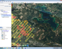
For anyone interested on how to access the Google Earth "current" (not exactly sure when updated) Fire Map.
-Download Google Earth, and open it
- Go to: https://fsapps.nwcg.gov/googleearth.php?sensor=viirs&extent=canada
-Click the "Current" hyperlink beside Fire Detections (VIIRS 375m)
- Once done downloading, open it, and it should load these hotspots you're seeing on my picture.
Hope that helps some people looking for updates